Found
Texts
Transliteration
oau/a^tua/t^aua
Normalisation (Old Norse)
...
Normalisation (Scandinavian)
...
Translation (English)
...
Location
- Found location
- Torpo kirke
- Parish
- Torpo sn
- District
- Buskerud fylke
- Municipality
- Ål
- Oldest known latitude and longitude
- 60.664050, 8.708390
Classification
- Carver
- —
- Number of crosses
- 0
- Cross form
- —
- Rune type
- —
- Style
- —
- Dating
- Middle ages
References
Images
-
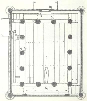 Floor plan showing the location of the runic inscription. Drawing: Riksantikvaren. CC-BY-SA 4.0
source: https://www.arild-hauge.com/Stavkirker/Torpo_stavkirke_grunnriss_med_runeinnskrift_Lilten.jpg
-
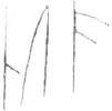 Image shown in the inscription section (no separate image caption provided).
source: https://www.arild-hauge.com/Stavkirker/N118_Torpo_stavkirke_IX_kalkering.jpg
-
 Image shown in the inscription section (no separate image caption provided).
source: https://www.arild-hauge.com/Stavkirker/N118_Torpo_stavkirke_IX_runeinnskrift.jpg